 Watch Walks
GR R2 (Réunion)
Cross Réunion end to end — three cirques, a roadless village, and the roof of the Indian Ocean.
There are 144 km between the two ends of GR R2 (Réunion), and Le Baril is the far one. It starts at Saint-Denis. Your ordinary week counts toward all of it: at 5,000 steps a day that's about 6 weeks, with no flights and no leave. Below are the 19 places you pass, and what happened at each one.
- 144km end to end
- 19landmarks
- 6 weeksat 5,000 steps a day
- Le Barilfinishes at
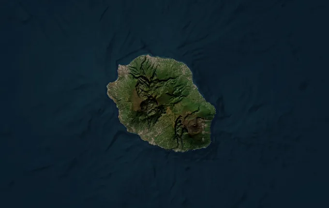
The landmarks of GR R2 (Réunion)
19 landmarks, in walking order.
-
Saint-Denis
The GR R2 begins at sea level in Réunion's capital, a French city of 150,000 in the Indian Ocean with Madagascar 800 km west. Ahead: 144 kilometres diagonally across the island, and every metre of Piton des Neiges to climb. The street grid gives out within the hour and the ramparts begin.
-
Gîte de la Plaine des Chicots
Tamarin forest, wet and mossy, and the first mountain hut. The Plaine des Chicots sits below La Roche Écrite, and Réunion's endemic cuckooshrike — the tuit-tuit, down to a few dozen pairs — lives in this forest and almost nowhere else. Bunks are booked months out. The Indian Ocean is already a long way below.
-
Dos d'Ane
Dos d'Ane means donkey's back, which is what the village sits on: a narrow ridge with a ravine falling away on either side. It is the last place with a road before Mafate. Below and ahead, the cirque opens — and nothing in it can be reached by car.
-
Deux Bras
Two rivers meet at the bottom of the Rivière des Galets and the way into Mafate goes up between them. This is the front door of the cirque. From here every village is supplied by helicopter or on somebody's back — there has never been a road, and there is no plan for one.
-
Chez Johnny (Îlet à Bourse)
An îlet is a shelf of flat ground in a cirque otherwise made of cliffs, and people live on them. Îlet à Bourse holds a few dozen. Mafate is the collapsed caldera of Piton des Neiges, and in the 1700s escaped slaves — marrons — hid in exactly these folds; the cirque still carries their names.
-
Grand Place Cayenne
Grand Place clings to the west wall with the Rivière des Galets a long way down. Children here go to school in the cirque and leave it on foot. The gîte serves rougail saucisse and the beer came in by helicopter, which is why it costs what it costs.
-
Roche Plate
Under the Maïdo rampart, which rises 1,000 metres straight out of the îlet and is the postcard everyone photographs from the other side. Down here you are IN the postcard, looking up. The path onward climbs the cirque's spine.
-
La Nouvelle
Mafate's largest îlet and its unofficial capital: a school, a chapel, several gîtes, a football pitch mown flat on a plateau at 1,400 metres. No car has ever driven here. It is the friendliest night on the traverse and the hardest one to leave.
-
Marla
The highest îlet in Mafate at about 1,600 metres, and the last. From the col above, the cirque you have crossed lies behind and Cilaos waits over the wall. Marla is where walkers compare blisters and lie about tomorrow's climb.
-
Les Trois Salazes
Three basalt teeth stand 2,132 metres up on the ridge dividing Mafate from Cilaos — the harder core of old vents, left standing after the softer rock around them washed away. They are the landmark of this crossing and visible from both cirques.
-
Col du Taïbit
2,082 metres, and the only walking gate between Mafate and Cilaos. The climb is relentless and the view at the top is both cirques at once — the one you crossed, and the one you are dropping into. Cloud usually arrives by eleven and takes the lot.
-
Cilaos
The name comes from Malagasy tsilaosa — the place you do not leave — and it was a marron refuge before it was a spa town. Now it has thermal baths, hairpin roads, embroidery, and lentils with an appellation of their own. A real bed, and a real meal, at 1,200 metres.
-
Piton des Neiges
3,070 metres: the highest point in the Indian Ocean, and the extinct volcano whose collapse made all three cirques. Walkers leave the refuge around three in the morning to be on top for sunrise, because by nine it is usually cloud. Snow is rare enough that the name is close to a joke.
-
Refuge de la Caverne Dufour
2,478 metres, and the coldest night on the island. The refuge is stone, the blankets are thin, and nobody sleeps past two — everyone is getting up for the summit anyway. Water is rationed; it comes up the mountain the same way you did.
-
Bourg Murat
Down off the massif and onto the Plaine des Cafres, high pastureland where Réunion keeps its cows and makes its cheese. Bourg Murat is the staging post for the volcano. The walking is easy for a day, which the legs need.
-
Nez de Boeuf
2,124 metres, on the rim of the Rivière des Remparts — a canyon a kilometre deep cut into the old flank of the volcano. The drop from the edge is sudden and complete. Ahead the ground turns black and the plants stop.
-
Piton de Bert
2,274 metres on the rim of the Enclos Fouqué, the horseshoe the active volcano sits inside. Piton de la Fournaise erupts on average every nine months and the lava runs east to the sea, sometimes across the road. This is as close as the trail goes.
-
Gîte de Basse-Vallée
The forest comes back, and with it warmth and mosquitoes and the smell of the sea. Last night on the trail, 1,000 metres up, with the coast visible below and the whole island behind.
-
Le Baril
The path lands on the south-east coast at Le Baril, where the lava flows reach the water and the sea works at them. Cap Méchant is a few minutes away — black rock, white surf, no beach. Nine days ago you were at sea level on the other side of the island.
Walking GR R2 (Réunion)
Your watch is already counting these steps. Watch Walks spends them on GR R2 (Réunion), all 144 km of it, and hands you each landmark as you reach it. There's no route recording, no account and no ads. The Inca Trail is free; this one is a one-time purchase with no subscription.
Other trails in Africa
- Walk the Nile 1,500 km · Egypt
- High Atlas Traverse 303 km · Morocco
- Kilimanjaro (Machame Route) 45 km · Tanzania
- Mount Kenya (Chogoria Route) 39 km · Kenya
- Otter Trail 37 km · South Africa
- Kilimanjaro (Lemosho Route) 70 km · Tanzania