 Watch Walks
Kilimanjaro (Lemosho Route)
Climb Lemosho, the quiet western route, over the Shira Plateau to Uhuru Peak.
70 km through Tanzania, ending at Mweka Gate. You begin at Lemosho Gate. Watch Walks moves you along it with the steps you already take, so it's about 3 weeks at 5,000 steps a day. Here are its 13 landmarks, in the order you meet them, and what each one is.
- 70km end to end
- 13landmarks
- 3 weeksat 5,000 steps a day
- Mweka Gatefinishes at
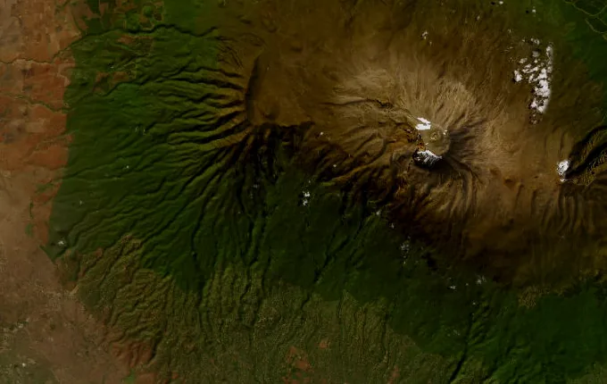
The landmarks of Kilimanjaro (Lemosho Route)
13 landmarks, in walking order.
-
Lemosho Gate
Rangers sign the party in at 2,100 metres and mention, without making much of it, that buffalo and elephant use this track too. Lemosho is the newest of the main routes and the least walked, which is most of its appeal — the western forest is quiet in a way the southern gates never are. The climb starts at once, under a closed canopy, on soft red earth.
-
Mti Mkubwa (Big Tree Camp)
Mti Mkubwa means big tree, and the camp is named for exactly that: a stand of podocarps rising out of the montane rainforest at 2,891 metres. Colobus monkeys work the canopy in black-and-white flashes. Everything drips — the moss, the lichen, the tents. Kibo is somewhere above all this, entirely hidden by leaves.
-
Shira 1 Camp
Forest stops, and the Shira Plateau opens out — a tilted moorland at 3,500 metres that is really the filled caldera of Shira, oldest of Kilimanjaro's three cones, collapsed roughly half a million years ago. Kibo shows itself across the plain, glaciered and much too far away.
-
Shira 2 Camp
Crossing the plateau eastwards takes a day and ends at 3,850 metres, among tussock grass and everlasting flowers. Giant lobelia stand about like fence posts. Southward, the Shira Cathedral cuts the skyline, a jagged leftover of the old crater rim. Nights up here are hard and clear, and the cold has real teeth.
-
Lava Tower
Softer rock eroded away and left this: a plug of solidified magma standing 4,689 metres up in the alpine desert. The trail comes here not to go anywhere but to be high for an hour — climb high, sleep low, let the blood catch up. Most walkers feel it, a dull headache and a shortness of breath. Machame joins from the right, and the mountain gets busier.
-
Barranco Camp
Dropping off Lava Tower lands you in a valley that looks invented: giant groundsels three metres tall, branched like candelabra, growing nowhere on earth but these few mountains. Camp sits at 3,970 metres under the Barranco Wall, 250 metres of rock that tomorrow starts by climbing. Giving back 700 metres of hard-won altitude is the point, not a setback.
-
Karanga Camp
Beyond the Wall comes the Karanga Valley, a steep in-and-out the legs remember. Camp at 3,961 metres holds the last running water on the mountain; everything above it is carried up, and porters make the round trip down and back with jerry cans. The summit dome looks close enough to touch now — a trick of the thin air.
-
Barafu Camp
Barafu is Swahili for ice, and the camp earns it: 4,666 metres on an exposed ridge of loose rock, tents pitched wherever a flat metre can be found. Nobody sleeps much. Wake near midnight, climb in the dark, and the summit arrives with the sun.
-
Kosovo Camp
Higher and colder than Barafu at around 4,800 metres, used by parties who would rather trade a worse night for a shorter push. It cuts perhaps an hour off the dark. Either way the trade is real: sleep badly low, or sleep worse high.
-
Uhuru Peak
5,895 metres — the highest point in Africa, and the highest free-standing mountain on earth, with no range to belong to. Uhuru means freedom in Swahili, the name given at Tanzanian independence in 1961. The sign is weathered and photographed by everyone; the glaciers behind it are visibly smaller than in pictures taken thirty years ago. Then you turn around, because nobody can stay up here.
-
Millenium Camp
What took a week to gain, the descent gives back in a few hours. Heath returns at 3,810 metres, and with it a thickness to the air that feels almost like a meal. Knees complain where lungs did.
-
Mweka Camp
Rainforest again at 3,063 metres: mud, moss, birdsong. The mountain is out of sight for good, hidden by the same canopy that hid it on the first morning. Boots are wrecked. Oddly, the last night on the mountain is the warmest one.
-
Mweka Gate
Forest track widens, turns to tarmac, and it is over at 1,640 metres. Certificates get signed at the gate — green for Stella Point, gold for Uhuru. Porters sing. Kilimanjaro is behind the trees now and gives no sign it was ever there.
Walking Kilimanjaro (Lemosho Route)
Your watch is already counting these steps. Watch Walks spends them on Kilimanjaro (Lemosho Route), all 70 km of it, and hands you each landmark as you reach it. There's no route recording, no account and no ads. The Inca Trail is free; this one is a one-time purchase with no subscription.
Other trails in Africa
- Walk the Nile 1,500 km · Egypt
- High Atlas Traverse 303 km · Morocco
- Kilimanjaro (Machame Route) 45 km · Tanzania
- Mount Kenya (Chogoria Route) 39 km · Kenya
- Otter Trail 37 km · South Africa
- GR R2 (Réunion) 144 km · Réunion